Spotlight: Sterlochy Pier

Home / Understanding Climate Change / Spotlight: Sterlochy Pier
⚠️ Closer to home · Flood risk

Findochty's known flood risk area, and what the long-term trend looks like here specifically.

📅 Data as of August 2026 · reviewed periodically

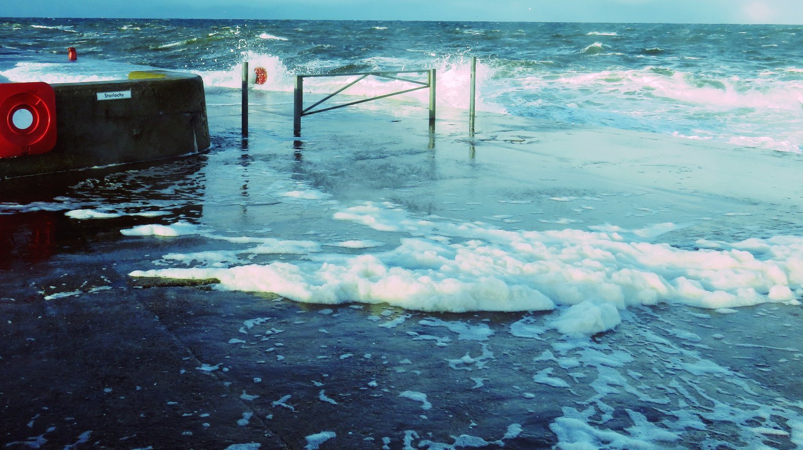
FCC's Severe Weather page identifies Sterlochy Pier and the harbour off Sterlochy Street as Findochty's established flood risk area, with wave overtopping during storms plus surface water flooding on low-lying streets.

📌 What this resource adds: the trend. These events are expected to become more frequent over time. This does not mean that any single day is more or less likely.

📊 The numbers that matter

+20cm Global mean sea level rise since 1900
+19.5cm UK sea level rise since 1901; last three years the highest on record
30–91cm Projected rise at Edinburgh by 2100 (UKCP18); nearest comparison, as no Findochty-specific figure exists

Rising sea level gives every future storm surge a higher baseline to build on. Over time, this tends to push events like wave overtopping from occasional to routine, though there's no figure for how much more often, specifically here.

📝 Why doesn't this show up on official flood maps? Findochty isn't among the 26 areas currently designated a Potentially Vulnerable Area under Scotland's official flood risk planning. The nearest designated area is Buckie and Portgordon, a few miles west. This isn't necessarily because the risk here is negligible: the North East Local Flood Risk Management Plan (2022–2028) states that its coastal flood mapping doesn't yet account for wave overtopping, the exact mechanism identified above at Sterlochy Pier, a gap acknowledged across nearly every coastal area in the plan, not unique to Findochty.

📷 Visual reference

Wave overtopping at Sterlochy Pier, Findochty, 2026. Storm waves breaking over the harbour wall and onto the pier, illustrating the flood risk facing this coastal area. Photo: Findochty Community Council.
Sterlochy Pier, Findochty, 2026. Photo: Findochty Community Council.

⚡ What this means in practice

🔑 The bottom line: The trend is clear. Events like wave overtopping at Sterlochy Pier are expected to become more frequent over time as sea levels continue to rise. This doesn't mean every storm will cause flooding, but the baseline risk is increasing.

📍 See also: Scotland's changing climate for the wider regional picture.

Sources: FCC Severe Weather page (findochty-cc.org/severe-weather); SEPA flood maps; Met Office State of the UK Climate, 2024 edition, for the UK sea level figure (metoffice.gov.uk); Met Office UK Climate Projections (UKCP18), sea level projections. Aberdeenshire Council (lead authority, North East Local Plan District), Local Flood Risk Management Plan 2022–2028, December 2022. See also Scotland's changing climate for the wider regional picture.